Understanding boundary and contour surveys
Boundary and contour surveys are integral components in the realm of property development. These surveys not only define the physical limits of a parcel of land but also reveal the topographical features that may influence the way property is developed. Understanding these surveys is crucial for developers who seek to maximise the potential of their properties, ensuring that their plans align with both regulatory requirements and natural land characteristics.
Boundary surveys provide an accurate depiction of property lines, vital for avoiding disputes with neighbouring properties. Establishing boundary locations is especially important for older properties to ensure proper registration with Land Registry Services. Contour surveys, on the other hand, illustrate the elevation of the land, indicating slopes, hills, and depressions. This topographical data plays a significant role in determining drainage patterns, landscaping opportunities, and the structural integrity of future constructions. By meticulously analysing the contours, developers can strategically position buildings to take advantage of natural light and views, enhancing the overall appeal of the property.
Understanding Property Boundaries
Understanding property boundaries is crucial for any landowner, as it helps to avoid potential legal disputes with neighbours or local councils. A property boundary is the physical limit of a land parcel, usually marked by a fence, wall, or other visible feature. However, these boundaries can be unclear or disputed, which is where a boundary survey comes in.
A boundary survey is a meticulous process that involves identifying and marking the corners of a property, as well as determining the relationship between the property and its surroundings. This process is typically performed by a registered cadastral surveyor, who uses specialised equipment and techniques to ensure accuracy. By having your boundaries surveyed, you can clearly define your land ownership, preventing any potential encroachments or legal issues. This clarity is not only beneficial for current landowners but also essential when planning any future developments or transactions involving the property.
The importance of accurate surveys in property development
Accuracy in boundary and contour surveys is not just beneficial; it is paramount. Developers rely heavily on precise surveys to create plans that comply with local zoning laws and building codes. Inaccuracies can lead to costly legal disputes, stalled projects, and even the potential need for redesigns to meet regulations. Furthermore, the ramifications of inaccurate surveys can ripple through the entire development process, affecting timelines and budgets, which are often already under pressure. The boundary survey process typically involves two main phases: reviewing land records and conducting a field survey. This starts with a qualified surveyor examining deposited plans and title certificates, followed by a physical inspection of the property to mark boundaries and collect data.
Moreover, the implications of an inaccurate survey can extend beyond financial costs. Poorly defined boundaries could lead to encroachments, while flawed contour information might result in inadequate drainage systems, causing long-term issues such as flooding or erosion. Thus, investing in accurate surveys early in the development process can prevent significant headaches down the line. It is also worth noting that local authorities may require these surveys as part of the planning permission process, making them not just a good practice but a necessary step in any development project.
Key elements of the boundary survey process and contour surveys
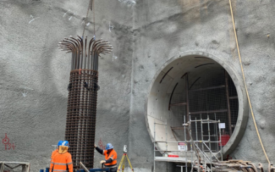
Several key elements contribute to the efficacy of boundary and contour surveys. First, robust field measurements taken using advanced surveying equipment are essential. Technology such as GPS and total stations allows surveyors to gather data with greater precision than traditional methods. Contour surveying is the process of creating detailed maps that illustrate the land’s contour lines, which represent different elevations. These technological advancements have revolutionised the surveying industry, enabling professionals to produce highly accurate and detailed maps that are indispensable for developers.
Additionally, comprehensive examinations of historical property records ensure that all existing boundaries are accurately represented. Surveyors must also consider the terrain’s natural features, utility lines, and any relevant easements that may affect property usage. The integration of Geographic Information Systems (GIS) further enhances the survey process by allowing surveyors to visualise and analyse spatial data more effectively. All these elements culminate in a cohesive and reliable survey that acts as the foundation for sound property development decisions. By utilising these sophisticated tools and methodologies, developers can make informed choices that not only meet regulatory standards but also enhance the sustainability and functionality of their projects.
Our unique approach to surveying
At our firm, we take a unique approach to surveying that distinguishes us from competitors. We pride ourselves on blending traditional surveying methods with cutting-edge technology. This combination allows us to produce surveys that are not only accurate but also facilitate a smoother development process.
Working closely with property developers from the outset, we ensure that our surveys address their specific needs and concerns. By fostering collaborative relationships, we create an environment where comprehensive data collection is achieved, ultimately benefiting all parties involved. A site survey is crucial for boundary identification, compliance with local council requirements, and planning for construction projects. Our team is dedicated to understanding the nuances of each project, which allows us to tailor our services effectively. This personalised approach not only enhances the quality of our surveys but also builds long-lasting partnerships with our clients, who appreciate our commitment to their success.
The Survey Process
The survey process typically involves two critical phases: research of land records and a field survey. During the research phase, the surveyor meticulously reviews the property’s deposited plans and title certificates to gather comprehensive information about the property’s boundaries and any relevant restrictions or easements. This thorough examination of historical records ensures that all existing boundaries are accurately represented and any potential issues are identified early on.
The field survey phase involves physically measuring the distances and verifying the accuracy of the data collected during the research phase. The surveyor uses specialised equipment, such as robotic total stations and electronic levels, to take precise measurements of the property’s boundaries and features. This hands-on approach ensures that the data is not only accurate but also reflective of the current state of the property.
Once the field survey is complete, the surveyor analyses and verifies the data to prepare the boundary survey report and sketch plan. This document provides a detailed depiction of the boundary lines and any relevant features, such as easements or restrictions. In some cases, a contour survey may also be necessary to determine the slope and elevation of the land. This information is crucial for designing and building structures, such as retaining walls, and for ensuring compliance with local building codes and regulations.
Overall, understanding property boundaries and the survey process is essential for any landowner or developer. By working with a registered cadastral surveyor, you can ensure that your property boundaries are accurately identified and marked, and that you have the information you need to make informed decisions about your land. This proactive approach not only safeguards your land ownership but also lays a solid foundation for any future development projects.
Incorporating technology in our field survey methods
The incorporation of technology into our surveying methods significantly enhances both efficiency and accuracy. We utilise advanced software for data analysis and mapping, transforming raw survey information into easily interpretable insights. This digital advancement allows developers to visualise their land’s potential in ways that were previously unattainable. By integrating Geographic Information Systems (GIS) into our workflow, we can layer various data sets, providing a comprehensive overview of the site’s characteristics, including topography, zoning, and environmental considerations. Closely spaced contour lines indicate a steep slope, which is crucial information for builders, architects, and engineers when planning site works and making construction decisions.
Furthermore, employing drone technology for aerial surveys provides a bird’s-eye view of the landscape, enabling us to capture details that ground-based measurements might miss. Such innovative tools put us at the forefront of the surveying industry, making our reports not just informative but transformative for property development. The ability to conduct rapid aerial assessments means that we can deliver timely insights, allowing developers to make informed decisions quickly. This agility is particularly advantageous in fast-paced markets where time is often of the essence.
Ensuring precision and accuracy in our surveys
Precision and accuracy are non-negotiable in our surveying practices. We believe that meticulous attention to detail is vital, and our team is trained to adhere to the highest standards of surveying. Regular calibration of our equipment ensures that our measurements remain sharp, reducing the likelihood of errors during data collection. A detail survey captures the existing landscape features and levels, aiding architects and builders in the design process and ensuring compliance with regulations. Our commitment to continuous professional development ensures that our surveyors are well-versed in the latest techniques and technologies, further enhancing the reliability of our results.
Additionally, we conduct thorough reviews of our findings before presenting them to clients. By implementing a rigorous quality-control process, we can confidently deliver surveys that adhere to regulatory standards and instil trust in our clients’ decisions. Our internal audits and peer reviews serve as additional layers of scrutiny, ensuring that every survey we produce meets our exacting standards. This dedication to quality not only safeguards our reputation but also reinforces our clients’ confidence in the integrity of our work, ultimately contributing to the successful execution of their projects.
The role of our surveyors in property development
Our surveyors play a crucial role in the property development process. They are not only skilled technicians but also advisors who guide developers in making informed decisions based on the survey data collected. Their expertise goes beyond simple measurements; they interpret and contextualise this information within the broader scope of a development project. Contour surveys are essential in planning and executing a building project, ensuring accuracy and compliance.
Through continuous professional development, our surveyors stay updated with the latest industry trends and regulatory changes, allowing them to provide cutting-edge insights to our clients.
The expertise of our surveyors
The expertise of our surveyors cannot be understated. Each member of our team possesses a wealth of knowledge in land surveying principles, legal implications concerning property boundaries, and relevant technological advancements. This extensive background ensures that they can handle even the most complex surveying tasks with competence and confidence.
Additionally, our surveyors are trained to communicate effectively with developers, ensuring that technical jargon is translated into understandable terms. This clear communication fosters meaningful collaboration and ultimately leads to successful project outcomes. The design phase is crucial in the home-building process, where architects and design teams make informed decisions based on preliminary surveys.
Collaborative work with property developers
Collaboration with property developers is at the heart of our approach. We understand that every development project is unique, which is why we tailor our services to meet specific client needs. By establishing open lines of communication, we encourage dialogue that yields valuable insights on project scope and requirements.
Our commitment to teamwork ensures that all parties are aligned throughout the surveying process. Regular updates and consultations allow us to adapt swiftly to any challenges or changes in the project landscape, ensuring that our surveys remain relevant and useful. Identifying and recording existing features of a property, such as vegetation and structures, within the context of contour surveys is crucial for builders and architects to effectively plan construction and development projects.
Overcoming challenges in boundary and contour surveys
Boundary and contour surveys often present unique challenges, particularly when dealing with complex property layouts. From irregular-shaped lots to existing structures that may obscure boundary lines, our team is adept at navigating these hurdles to deliver accurate surveys.
Moreover, we approach these challenges with a problem-solving mindset, leveraging our expertise to find innovative solutions that allow the surveying process to progress smoothly. Contour lines represent different elevations on a property, providing essential information for builders, architects, and engineers in planning construction and development.
Dealing with complex property layouts
Complex property layouts may require a multifaceted approach. Our surveyors are trained to handle various terrain types and land uses, enabling us to offer tailored solutions. Whether the site includes steep slopes, significant vegetation, or unusual angles, we adapt our methods to ensure thorough data collection.
Using a combination of traditional surveying techniques and modern technology, we accurately delineate boundaries and contours even in the most challenging conditions. A contour survey helps determine the elevation and steepness of land by providing detailed contour lines. The result is a reliable survey that provides developers with the confidence to move forward with their projects.
Addressing potential legal issues in property boundaries
Legal issues often arise around property boundaries, making thorough surveys even more critical. Our surveyors are knowledgeable in land laws and regulations, ensuring that their work adheres to legal standards while appropriately addressing potential disputes.
As part of our service, we provide comprehensive consultations regarding boundary interpretations and potential encroachments. This proactive approach ensures that developers are aware of any legal considerations ahead of time, allowing them to make informed decisions during the planning stages. Site surveys play a crucial role in the home-building process by mapping land features and levels, which can inform architects and engineers during the design phase.
Delivering comprehensive survey reports
Upon completion of a survey, we deliver comprehensive reports that detail our findings in a clear and concise manner. These reports serve as valuable tools for developers, guiding them through the subsequent stages of their projects. Detail surveys provide essential information for project planning, enabling architects and designers to create compliant and effective designs.
Each report includes visual aids such as maps and diagrams, alongside written explanations that clarify our measurements and implications. The clarity of these documents enables developers to grasp complex survey data quickly and effectively.
What our survey reports include
Our survey reports encompass a range of essential elements, including boundary delineations, topographical data, and any identified discrepancies in property lines. Additionally, we include recommendations based on our findings, aiding developers in their decision-making process.
Each report is tailored to meet the specific needs of the project, ensuring that the information presented is not only comprehensive but also directly relevant to the developer’s objectives. A contour detail survey captures the existing landscape features and levels, aiding architects and builders in the design process and ensuring compliance with regulations.
Interpreting the survey results for property development
Interpreting contour and boundary survey results can often feel daunting. However, we prioritise making this process as accessible as possible for our clients. Our team is committed to meeting with developers to discuss survey outcomes, answering any questions they may have about the implications of the data.
We guide developers through the nuances of how survey results influence their development plans, empowering them to make strategic decisions. Contour surveying aids in visualising the site’s topography, planning site works, and making informed decisions regarding construction. This support ensures they can navigate the complexities of property development with confidence, backed by reliable, precise information from our surveys.