Understanding the importance of accurate land surveys
Accurate land surveys are the foundation of successful property developments. In Sydney, where urbanisation and land use are constantly evolving, the significance of precise surveys in land development projects cannot be overstated. The data derived from these surveys guide property developers, architects, and planners in making crucial decisions that affect the very fabric of our cities and towns.
Land surveys act as the foundational framework for understanding the topography, boundaries, and resources of a given parcel. They help identify land constraints and opportunities, ultimately informing planning decisions. Whether it’s a residential space or a large commercial development, accuracy ensures that every design element aligns with the physical reality of the site.
What is Land Surveying?
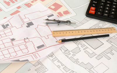
Land surveying is both a science and an art dedicated to measuring and mapping the Earth’s surface. This practice is essential for determining property boundaries, identifying land features, and establishing reference points crucial for construction and development projects. Land surveyors collect precise data to create accurate maps and plans using advanced technology such as GPS, total stations, and drones. This meticulous process ensures that properties are correctly defined and that construction projects are built on the appropriate land. In the realm of property development, land surveying is a foundational step that guarantees the integrity and success of subsequent construction efforts.
The role of land surveys in property development
In property development, the role of land surveys goes far beyond simply mapping out property boundaries. Land parcels are critical for defining property boundaries and facilitating property sales. The insights gained from these surveys allow developers to understand existing conditions, such as site elevations, drainage patterns, and soil types. This information is critical as developers assess the feasibility of their proposed projects.
Moreover, accurate surveys reduce the risk of costly mistakes. If boundaries are misinterpreted, it could lead to disputes with neighbouring properties or non-compliance with zoning laws. By employing precise surveying techniques from the outset, developers can avoid these pitfalls, ultimately leading to smoother project approvals and execution.
Why You Need a Land Surveyor?
Engaging a professional land surveyor is indispensable for property owners, developers, and builders. A land surveyor provides the critical service of determining property boundaries, identifying land features, and establishing reference points for construction projects. The accurate and reliable data they provide is essential for ensuring that properties are developed correctly and that construction projects are built on the right land. Moreover, a land surveyor can identify potential issues such as easements, zoning restrictions, and environmental concerns, which could impact the development process. Their expertise helps mitigate risks and ensures compliance with all relevant regulations, paving the way for successful project execution.
Why accuracy matters in land surveys
The stakes are high in land surveying. One small measurement error can lead to disastrous consequences, ranging from legal disputes to structural failures. This is particularly emphasised in Sydney, where land is at a premium, and the demand for new developments is ever-increasing. A reliable land survey ensures the accuracy needed to support financial investments and community well-being.
In addition to legal implications, accuracy directly influences the design and engineering processes. Architects and engineers rely on precise land surveys to develop appropriate designs that conform to both aesthetic and functional standards. This interconnectedness illustrates just how vital accurate surveys are to the entire development lifecycle.
Furthermore, technological advancements in surveying methods, such as the use of drones and 3D laser scanning, have significantly enhanced the accuracy and efficiency of land surveys. These modern techniques allow for quicker data collection and provide a more comprehensive view of the land, enabling developers to make informed decisions based on detailed topographical data. As urban environments become increasingly complex, the integration of technology in surveying practices is not just beneficial but essential for keeping pace with the demands of contemporary property development.
Moreover, the implications of accurate land surveys extend into environmental considerations as well. Understanding the natural features of a site, such as vegetation, waterways, and wildlife habitats, can influence the design and planning of developments. By incorporating environmental assessments into the surveying process, developers can ensure that their projects are sustainable and in harmony with the surrounding ecosystem, ultimately contributing to the preservation of Sydney’s unique natural heritage.
Our approach to land surveys Sydney
At the heart of our land surveys is a commitment to accuracy and reliability. We believe that a systematic approach is essential for delivering quality surveys that meet our client’s needs. From utilising advanced technology to harnessing the expertise of seasoned Sydney surveyors, our methodology is designed to leave no room for error.
We recognise that each surveying project presents unique challenges, and our tailored approach allows us to address these effectively. By integrating cutting-edge tools with traditional surveying techniques, we ensure that our data collection process captures the full complexity of each site.
The technology we use for precision
To achieve the highest levels of accuracy, we use state-of-the-art technology in our surveying projects. Our land surveyors use Global Positioning System (GPS) devices, laser scanning, and Geographic Information Systems (GIS), which allow for precise measurements and detailed analysis.
This advanced technology enhances the accuracy and efficiency of our surveys. For example, laser scanning allows us to create three-dimensional representations of the terrain, making it easier to identify features that may require special consideration during the planning stages.
Our team of experienced land surveyors
While technology plays a critical role, the expertise of our land surveyors is equally vital. Our team comprises skilled professionals with extensive experience in various types of land surveys. Their knowledge of local regulations, topographical nuances, and community dynamics ensures that we deliver comprehensive results tailored to the specific needs of each project.
Continuous training and professional development are cornerstones of our team’s success. We prioritise staying updated with industry standards and emerging technologies to provide our clients with the best possible service. This commitment to excellence has positioned us as a trusted partner for land surveys in Sydney.
The process of delivering accurate land surveys
Delivering accurate land surveys is not merely about taking measurements; it involves a series of meticulously planned steps that lead us to reliable conclusions. From the initial site assessment to the final reporting, each phase builds on the last to ensure comprehensive data collection and analysis.
The combination of careful planning, advanced tools, and skilled personnel ensures that we can provide our clients with survey results they can trust. Each project is approached with the utmost professionalism, guaranteeing that our clients remain fully informed throughout the process.
Initial site assessment and planning
Before conducting a survey, we emphasise the importance of a thorough initial site assessment. This includes evaluating the site’s topography, identifying potential issues, and understanding the project’s specific requirements. Such preparation allows us to anticipate challenges and plan our approach accordingly.
During this phase, we also liaise with stakeholders to clarify their expectations and ensure that our survey aligns with their project goals. This proactive communication is integral to fostering a strong working relationship and guarantees that the final product meets, if not exceeds, client expectations.
Conducting the survey: our step-by-step process
Once planning is complete, we execute our survey using a structured, step-by-step process. This includes setting up reference points, taking measurements with precision instruments, and meticulously documenting all findings. Each step is designed to enhance accuracy and minimise the risk of error.
After collecting the data, our team undertakes a comprehensive review process to assess the information and ensure it meets our stringent quality standards. Only once we are satisfied with the data do we proceed to the analysis and reporting phases, delivering a final product that stands up to scrutiny.
Quality assurance in our land survey process
Quality assurance is not an afterthought in our surveying process; it is seamlessly integrated into every phase of our work. By implementing rigorous quality checks and balances, we ensure that our surveys consistently meet the highest standards of accuracy and reliability.
The integrity of the data we provide is paramount, and our quality assurance protocols help us achieve this goal. We don’t just collect data; we guarantee it reflects the true condition of the site, thereby protecting our clients’ investments and interests.
How we ensure data accuracy
Wumara land surveyors employ a multifaceted approach to ensure data accuracy. This includes using redundant systems that cross-verify measurements and integrating feedback loops that allow our team to identify potential discrepancies early in the process. We believe that proactive measures are essential for maintaining accuracy throughout the surveying lifecycle.
Moreover, our commitment to accuracy extends beyond initial surveys. We routinely review our completed projects to learn from each experience, identify areas for improvement, and implement those insights in future work.
Our commitment to continuous improvement
A commitment to continuous improvement is essential in an ever-evolving field like land surveying. We actively seek feedback from clients and stakeholders, using this information to refine our processes and enhance our service delivery.
Workshops, training sessions, and industry conferences provide our team with the learning opportunities necessary to remain at the forefront of the surveying profession. Our unyielding dedication to improvement elevates our capabilities and assures clients of our commitment to delivering the highest standard of service.
Overcoming challenges in land surveying
The field of land surveying presents challenges, particularly in a dynamic and diverse urban environment like Sydney. However, we have developed effective strategies to navigate these obstacles, ensuring our clients receive accurate and reliable results regardless of external conditions.
Our approach remains steadfast despite environmental factors and legal complexities. We are equipped to tackle these challenges so that our clients can focus on their development objectives without unnecessary delays or scope changes.
Dealing with difficult terrains and environments
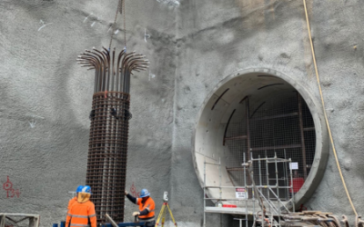
One of the foremost challenges in land surveying is navigating difficult terrains. Sydney’s varied landscape presents numerous obstacles, from steep hillsides to densely built environments. Our team is well-versed in employing adaptive techniques and technologies that allow us to collect precise data, no matter the conditions.
Utilising drones, for instance, enables us to survey hard-to-reach areas effectively. This adaptability is crucial in ensuring that every aspect of a project receives attention despite the complexities of the site.
Navigating legal and regulatory requirements
In addition to physical challenges, we must also navigate a complex legal landscape. Obtaining a strata plan is crucial in property development as it permits the division of buildings and structures situated on a single allotment. Property development in Sydney is often subject to numerous regulations, and understanding these requirements is essential for conducting successful land surveys.
Our deep understanding of local laws and regulations ensures that compliance is built into our processes. By addressing these legal considerations early in our surveying efforts, we mitigate risks for our clients and create a pathway toward successful project outcomes.
In conclusion, our unwavering dedication to accuracy, structured approach, and commitment to overcoming challenges make us a leader in delivering reliable land surveys in Sydney. With every project, we strive to not only meet client expectations but also set new standards within the industry.
Get in Touch with Our Land Surveying Team
Contact our team today if you need land surveying services for your next project. With our head office in Sydney, we provide services throughout NSW and beyond. Our experienced land surveyors are dedicated to delivering accurate and reliable results, utilising the latest advanced technology to ensure the highest quality service. We offer a wide range of services, including land surveying, spatial data management, and surveying services for both residential and commercial projects. Contact us at 1300 575 702 or info@wumaragroup.com.au today; we look forward to discussing your next project.