When embarking on a residential or property project, selecting the right surveyor is a critical step that can significantly influence the success of your venture. Choosing a licensed surveyor is essential to ensure the project is handled by qualified professionals who meet all legal requirements. Land surveying plays a vital role in understanding the boundaries, topography, and features of a property, ensuring that all planning and construction activities are executed smoothly. This guide aims to provide clarity on the various aspects of land surveying and how to choose the right surveyor for your needs.
Understanding Land Surveying
Land surveying is the process of measuring and mapping the land to determine its boundaries, contours, and features. This practice is essential for a variety of projects, including residential developments, commercial constructions, and land divisions. Surveyors use advanced technology and equipment to gather accurate data about the Earth’s surface, which is then used to create detailed maps and reports. The integration of Geographic Information Systems (GIS) has revolutionised the field, allowing surveyors to analyse spatial data more effectively and present it in visually engaging formats, which can be invaluable for stakeholders and decision-makers alike.
Furthermore, the role of land surveying extends beyond mere measurement; it is a critical component in the preservation of historical sites and natural landscapes. Surveyors often collaborate with environmentalists to ensure that construction projects do not adversely affect sensitive ecosystems. By conducting thorough surveys, they can identify areas of ecological significance and recommend measures to protect them, thus playing a vital part in sustainable development.
What is Land Surveying?
Land surveying is the meticulous process of determining the precise location and boundaries of a piece of land. This practice involves the use of specialised equipment and techniques to measure distances, angles, and shapes of the land, as well as its relationship to surrounding features. Land surveying is a crucial step in the development of any construction project, ensuring that the project is built on the correct land and that all necessary permits and approvals are obtained.
The complexity of land surveying requires a high degree of technical expertise and attention to detail. Professional land surveyors employ a variety of surveying instruments, including GPS units, total stations, and levels, to collect accurate data about the land. This data is then used to create detailed maps and legal descriptions of the property, which are essential for establishing property boundaries and identifying any potential issues or conflicts. By providing precise measurements and exact locations, land surveying plays a vital role in the successful execution of construction projects and the maintenance of legal land surveys.
The Importance of Land Surveying
Land surveying serves multiple purposes. It helps in identifying boundary lines and property lines, which is crucial for avoiding disputes with neighbours. Additionally, it provides essential information for planning permissions, ensuring compliance with local regulations. Accurate surveys can also identify potential issues such as drainage problems or land instability, which can save time and money during construction. The implications of a well-executed land survey can be far-reaching, influencing everything from property values to urban planning initiatives. In a rapidly changing world, where land use is constantly evolving, the insights provided by surveyors are indispensable for informed decision-making.
Moreover, land surveying plays a significant role in disaster management and urban resilience. By mapping areas prone to flooding, landslides, or other natural hazards, surveyors can assist local governments in developing strategies to mitigate risks. This proactive approach not only protects communities but also enhances the safety of infrastructure projects, ensuring they are built to withstand potential environmental challenges.
Benefits of Land Surveying
There are numerous benefits to land surveying, making it an indispensable part of property development and management:
- Ensuring Accurate Construction: Land surveying ensures that construction projects are built on the correct land, preventing costly mistakes and legal disputes. It also helps in obtaining all necessary permits and approvals, ensuring compliance with local regulations.
- Identifying Potential Issues: By identifying potential issues or conflicts with neighbouring properties or features, land surveying helps in resolving disputes before they escalate. This proactive approach can save time and money in the long run.
- Providing Detailed Maps and Legal Descriptions: Land surveys provide detailed maps and legal descriptions of the property, which are crucial for establishing property boundaries and resolving any disputes that may arise. These documents are essential for legal and financial transactions involving the property.
- Supporting Timely and Budget-Friendly Projects: Accurate land surveys help ensure that construction projects are completed on time and within budget by providing precise measurements and identifying any potential obstacles early in the planning process.
- Offering Valuable Land Information: Land surveying provides valuable information about the land, including its topography, soil composition, and other features. This information is essential for making informed decisions about land use and development.
By leveraging the expertise of professional land surveyors, property owners and developers can ensure the success of their construction projects and maintain clear and accurate property boundaries.
Types of Surveys and Surveying Instruments
Various types of surveys cater to different needs. A boundary survey is a specific type of land survey that identifies property corners and boundary lines using recorded deeds and physical markers, which is important for personal records and locating easements. Boundary surveys define the exact lines of a property, while topographic surveys illustrate the terrain’s features, including elevations and natural obstacles. An as-built survey is particularly useful for individuals planning large home constructions or landscape projects, as it provides highly accurate three-dimensional renderings and interior/exterior blueprints created by professional surveyors. Construction surveys ensure that building projects are executed according to the approved plans. Each type of survey serves a unique purpose, and understanding these distinctions can help in selecting the right surveyor. For instance, a hydrographic survey is essential for projects involving bodies of water, as it maps underwater features and helps in navigation and resource management.
In addition to these traditional types, modern surveying techniques have introduced methods such as aerial surveys using drones, which can cover large areas quickly and provide high-resolution imagery. This innovation not only enhances the efficiency of data collection but also allows for the monitoring of changes over time, which is particularly useful in sectors like agriculture and urban development. As technology continues to advance, the field of land surveying is likely to evolve further, offering even more precise and comprehensive insights into our land and its uses.
The Surveying Process
The surveying process typically involves several critical steps, each contributing to the creation of accurate and reliable land surveys:
- Research: The surveyor begins by conducting thorough research on the property. This includes reviewing existing maps, legal documents, and historical records to gain a comprehensive understanding of the land and its boundaries. This step is crucial for identifying any discrepancies or previous surveys that may impact the current project.
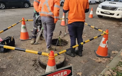
- Fieldwork: During the fieldwork phase, the surveyor visits the property to collect data using specialised surveying instruments. These tools, such as GPS units, total stations, and levels, are used to measure distances, angles, and shapes of the land. The surveyor meticulously records this data to ensure accuracy and precision.
- Data Analysis: After collecting the field data, the surveyor analyses it using advanced software. This analysis helps in creating detailed maps and legal descriptions of the property. The surveyor ensures that the data is accurate and that it aligns with the research conducted earlier.
- Map Creation: The surveyor then creates detailed maps of the property, highlighting its boundaries, features, and any potential issues or conflicts. These maps are essential for visualising the property and making informed decisions about its use and development.
- Report Preparation: Finally, the surveyor prepares a comprehensive report detailing the findings of the survey. This report includes legal descriptions, maps, and any recommendations or suggestions for the property owner. It serves as a valuable reference for future planning and development activities.
By following these steps, professional land surveyors provide accurate and reliable information that is essential for successful property development and management. The surveying process ensures that all legal descriptions and documents are precise, helping to avoid disputes and ensuring compliance with regulations.
Qualities to Look for in a Surveyor
Choosing the right surveyor involves assessing their qualifications, experience, and approach to work. Not all surveyors are created equal, and understanding what to look for can make a significant difference.
Professional Qualifications of Licensed Surveyors
It is essential to ensure that the surveyor holds the necessary qualifications and certifications. In the UK, surveyors should be registered with professional bodies such as the Royal Institution of Chartered Surveyors (RICS) or the Chartered Institution of Civil Engineering Surveyors (CICES). These organisations uphold high standards and provide assurance of the surveyor’s competence. Additionally, collaboration between surveyors and civil engineers is crucial in construction projects, as it ensures comprehensive design documents and successful project outcomes.
Experience and Specialisation
Experience plays a crucial role in a surveyor’s ability to handle complex projects. It is advisable to choose a surveyor who has a proven track record in the specific type of surveying required for your project. Whether it is residential, commercial, or industrial, a specialist will be more adept at navigating the unique challenges associated with that sector.
Communication Skills
Effective communication is vital in any professional relationship. A good surveyor should be able to explain technical concepts in a way that is easy to understand. They should also be responsive to queries and provide regular updates throughout the surveying process. This transparency fosters trust and ensures that all parties are on the same page.
Researching Potential Surveyors
Once you have identified the qualities you are looking for, the next step is to research potential surveyors. This phase is crucial in narrowing down your options and finding the right fit for your project.
Online Reviews and Recommendations
Online reviews can provide valuable insights into a surveyor’s reputation and the quality of their work. Websites such as Trustpilot and Google Reviews often feature customer feedback that can help inform your decision. Additionally, seeking recommendations from friends, family, or colleagues who have previously engaged a surveyor can lead to trustworthy referrals.
Portfolio of Previous Work
A reputable surveyor should have a portfolio showcasing their previous projects. This can include examples of surveys they have conducted, along with client testimonials. Reviewing their past work can give you an idea of their capabilities and the types of projects they excel in.
Initial Consultation
Many surveyors offer an initial consultation, which can be an excellent opportunity to gauge their expertise and approach. During this meeting, you can discuss your project, ask questions, and assess their understanding of your needs. Pay attention to how well they listen and whether they provide thoughtful responses.
Understanding Fees and Costs
Surveying fees can vary significantly based on the type of survey and the complexity of the project. Understanding the cost structure is essential for budgeting purposes.
Fee Structures
Surveyors may charge fees in various ways, including fixed rates, hourly rates, or based on the size of the project. It is advisable to request a detailed breakdown of the costs involved, including any additional expenses that may arise during the surveying process. This transparency will help avoid unexpected charges later on.
Comparing Quotes
Obtaining quotes from multiple surveyors can provide a clearer picture of the market rates. However, it is essential to compare not just the prices but also the services included in each quote. The cheapest option may not always offer the best value, so consider the overall quality and reputation of the surveyor.
Legal Considerations and Property Boundaries
Engaging a surveyor involves legal considerations that should not be overlooked. Understanding these aspects can protect your interests and ensure compliance with regulations.
Contracts and Agreements
Before commencing work, it is advisable to have a formal contract in place. This document should outline the scope of work, timelines, fees, and any other relevant terms. A well-drafted contract can prevent misunderstandings and provide a reference point should any disputes arise.
Insurance and Liability
Ensure that the surveyor holds professional indemnity insurance. This coverage protects both parties in the event of errors or omissions in the surveying process. It is essential to confirm that the surveyor’s insurance is adequate for the scope of your project.
Post-Survey Process
Once the survey is completed, there are several steps to follow to ensure that the findings are effectively utilised in your project.
Reviewing the Survey Report
The surveyor will provide a detailed report outlining their findings. A mortgage survey is essential before purchasing a home or property as it ensures that all structures are accurately represented, verifies property ownership, and confirms compliance with building and zoning regulations. It is crucial to review this document carefully, as it contains essential information regarding property boundaries, topography, and any potential issues. If there are aspects that are unclear, do not hesitate to ask the surveyor for clarification.
Implementing Findings
The insights gained from the survey should inform all subsequent planning and construction activities. Engaging with architects, builders, and other professionals using the survey data will ensure that the project proceeds smoothly and adheres to all regulations.
Conclusion
Choosing the right surveyor is a pivotal decision that can greatly influence the outcome of residential and property projects. By understanding the importance of land surveying, identifying the qualities to look for in a surveyor, and conducting thorough research, individuals can make informed choices. Additionally, being aware of the legal considerations and effectively utilising the survey findings will contribute to a successful project. With the right surveyor on board, property ventures can proceed with confidence, paving the way for successful outcomes.